ADMINEXPRESS 08-2022
The administrative divisions of the French territory (municipality, departmental district, department, region...).
Description
The ADMIN EXPRESS product contains the following data layers or object classes (in french):
- ARRONDISSEMENT (ARRON)
- ARRONDISSEMENT_MUNICIPAL (ARRMU)
- CANTON (CANTO)
- CHFLIEU_ARRONDISSEMENT_MUNICIPAL (CHFAM)
- CHFLIEU_COMMUNE (CHFCO)
- CHFLIEU_COMMUNE_ASSOCIEE_OU_DELEGUEE (CHFLC)
- COLLECTIVITE_TERRITORIALE (COLLE)
- COMMUNE (COMMU)
- COMMUNE_ASSOCIEE_OU_DELEGUEE (COMAS)
- DEPARTEMENT (DEPAR)
- EPCI (EPCI)
- REGION (REGIO)
It covers all French departments, including the overseas departments and regions.
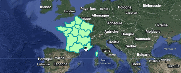
ADMIN EXPRESS allows cross-referencing with other data sources in order to build thematic representations of the territory according to an administrative scale (municipality, departmental district, department, region). The official dataset description is available here
Code Editor Snippet
// Import the datasets.
var regions = ee.FeatureCollection("projects/ee-france/assets/IGN/ADMIN_EXPRESS/202208/REGIO");
var communes = ee.FeatureCollection("projects/ee-france/assets/IGN/ADMIN_EXPRESS/202208/COMMU");


// Define a location of interest.
var lon = 5.04855;
var lat =  45.73616;
var poi = ee.Geometry.Point(lon, lat);

// Paint the dataset with appropriate palette.
var styleRegions = {
  fillColor: 'b5ffb4',
  color: '00909F',
  width: 2.0,
};

regions = regions.style(styleRegions);

var styleCommunes = {
  fillColor: 'grey',
  color: 'black',
  width: 1,
};

communes = communes.style(styleCommunes);

Map.addLayer(regions, {}, 'Regions');
Map.addLayer(communes, {}, 'Communes');

Map.setCenter(lon, lat, 6);